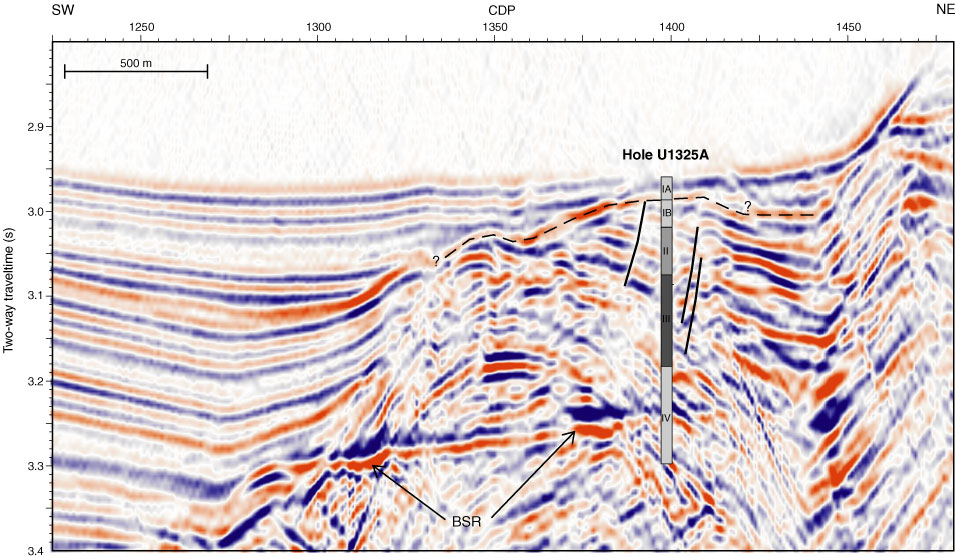
Figure F7. Section of MCS Line 89-08 over Site U1325. The data are of low seismic frequency content from 10 to 60 Hz. A buried ridge of accreted sediments can be identified between common depth points CDPs 1320 and 1440, covered by a thin interval of slope-basin-type sediments that form onlaps onto the ridge. Underneath the center of the ridge a bright spot is identified, potentially indicating the presence of free gas. A strong bottom-simulating reflector (BSR) is seen over much of the eastern section of the basin, whereas it disappears underneath the western part of the basin, filled with as much as 600 ms TWT thick slope-basin-type sediments. Site U1325 intersects an interval of 300 ms TWT thickness where sediments show strong eastward dip. Note the boundary between lithostratigraphic Subunits IA and IB is traceable for ~1.5 km around Site U1325. Several small-scale faults are visible, one of which was most likely penetrated at Site U1325 near the base of lithostratigraphic Unit II. Vertical exaggeration = 3.4.