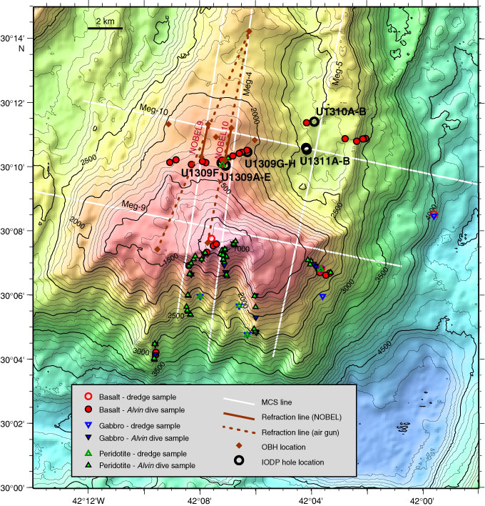
Figure F2. Base map of Atlantis Massif showing prior geological and geophysical data coverage and the location of Integrated Ocean Drilling Program (IODP) drill sites (circles). Bathymetry is contoured at 100 m intervals, based on a 100 m grid. Seismic reflection and refraction lines and seafloor mapping/sampling sites are shown. The corrugated detachment surface capping the central dome is inferred to extend beneath the eastern block, thereby making the upper crustal deposits part of the hanging wall to the fault. MCS = multichannel seismic. OBH = ocean bottom hydrophone.
Previous | Close | Next | Top of page