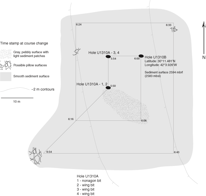
Figure F1. Map of Site U1310 operations area developed from subsea camera survey observations. The survey began at 0550 h on 11 December, following the expanding box illustrated by the straight lines (the actual path of the camera is not plotted, but tracking the camera via sonar indicated the camera followed the ship’s path). HRRS attempts are shown as Hole U1310A.