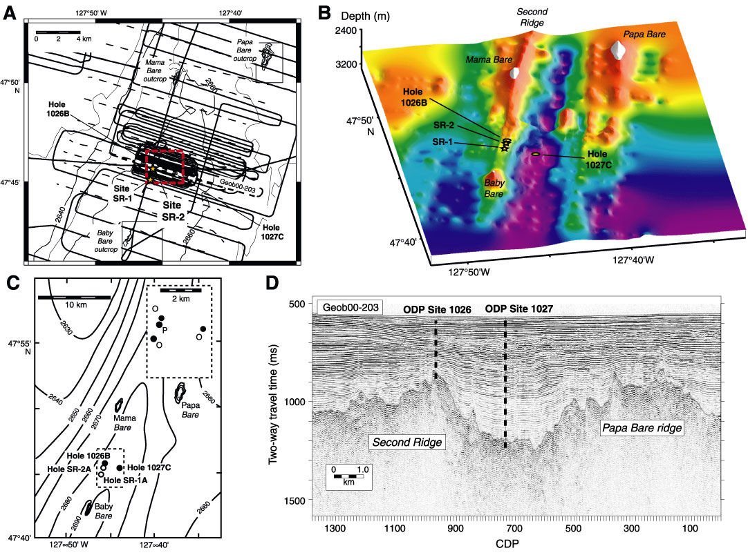
Figure F3. A. Second Ridge (SR) site map showing track lines from SO149 (solid lines) and older seismic data and locations of ODP Leg 168 drill holes. Seismic line spacing is 100 m within 1 km to the north-northwest and south-southeast of ODP Hole 1026B, with most lines oriented perpendicular to the structural strike of basement. Corks will also be replaced at Sites 1026 and 1027 during Expedition 301, but there will be no additional drilling at these sites. Detail of track lines, showing line numbers and common depth points (CDPs), is included in Figure F4. B. Topography of top of basement around Second Ridge based on multichannel seismic data collected during SO149, showing tops of outcrops (in white), Leg 168 Holes 1026B and 1027C, and proposed Sites SR-1 and SR-2 (stars) (figure courtesy of L. Zühlsdorff and V. Spiess, University of Bremen, Germany). C. Map view indicating spatial relations between Corked Holes 1026B and 1027C, Sites SR-1 and SR-2, and nearby basement outcrops. Inset shows relative locations of pumping (P) and observation (O) wells for cross-hole experiments, to be completed during a later expedition. Depth contours in meters. D. SO149 seismic Line GeoB 00-203, passing through Sites 1026 and 1027, whichpenetrate only into uppermost basement rocks. Seismic data passing through Site SR-1 are shown in Figure F5. This site is located 1000 m south of Site 1026, near the peak of the same buried basement ridge..