International Ocean Discovery Program
JOIDES Resolution Science Operator
Expedition 356 Photo Gallery · Week 5
Expedition 356 Photos · All Photo Galleries · Expeditions · Copyright IODP JRSO · Home
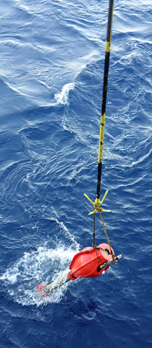
At each site, a sonar beacon is deployed to the sea floor. The beacon’s signal, along with satellite positioning data (GPS), is interpolated by the ship’s Dynamic Positioning System (DP), which adjusts the thrusters to hold the ship in position over the site. When operations are completed at the site, the sonar beacon releases a ballast and rises to the surface where it is retrieved. (Credit: Yuxin He & IODP) [Photo ID: exp356_132]