DSDP Site Map Poster
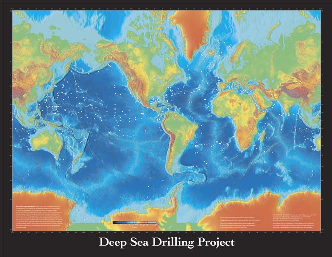
This map is based on a color-shaded relief map produced by the National Oceanic and Atmospheric Administration (NOAA) National Centers for Environmental Information (NEIC, previously NGDC). The following text explaining the history of the program is included on the poster.
THE DEEP SEA DRILLING PROJECT (DSDP; 1968–1983) pioneered scientific ocean drilling. Begun as a U.S. effort to use ocean drilling to examine the theory of plate tectonics and development of the ocean basins, DSDP expanded during the International Phase of Ocean Drilling (IPOD) that began in 1975 to provide important insights about past climate change, volcanism, and convergent margin tectonics. Scripps Institution of Oceanography at the University of California, San Diego, ran science operations using the dynamically positioned drillship Glomar Challenger, and the Joint Oceanographic Institutions for Deep Earth Sampling (JOIDES), a group of four U.S. universities, later augmented by additional domestic and international members, provided scientific guidance. During the program, 97,056 meters of core from 624 sites was retrieved and stored in core repositories, where the cores are still sampled for scientific research.
Download 46 × 35 inch poster (PDF; 5 Mb)
For additional information on scientific ocean drilling, please contact:
JRSO Science ServicesTexas A&M University
1000 Discovery Drive
College Station TX 77845
USA
information@iodp.tamu.edu
http://iodp.tamu.edu/
Tel: (979) 845-2673