Drill Site Maps
The maps are available free of charge and were produced using Generic Mapping Tools (GMT).
By Expedition
- Free expedition maps for research papers and presentations
- How to add drill sites to Google Earth (IODP science support office)
By Region
By Drilling Program
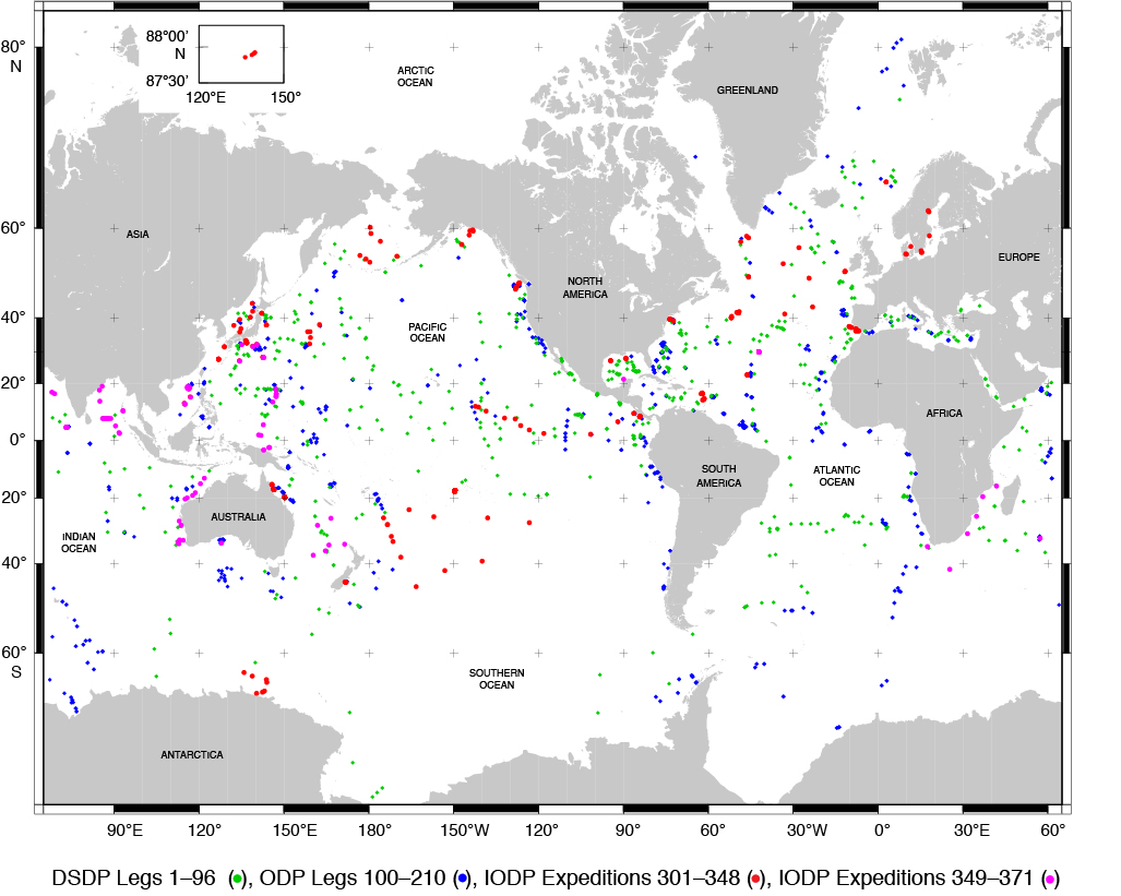
Combined IODP, ODP, & DSDP sites

IODP [International Ocean Discovery Program] Expeditions 349–405, Sites U1431–U1624 (JR), C0002, C0006, C0010, C0019, C0023, C0024, C0025, C0026 (Chikyu), and M0068–M0110 (mission-specific platforms)
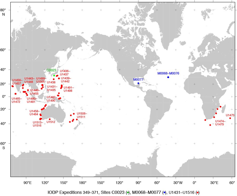
Color poster: See combined map above.
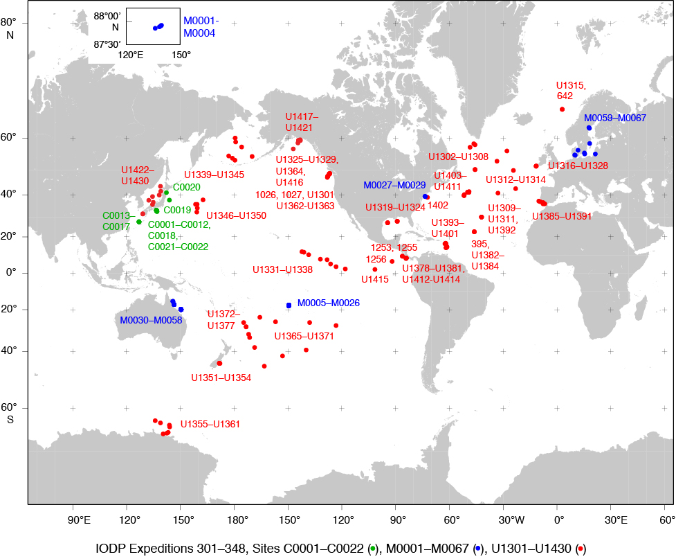
IODP [Integrated Ocean Drilling Program] Expeditions 301–348, Sites U1301–U1430 (JR), C0001–C0022 (Chikyu), and M0001–M0067 (mission specific) (final)
Labeled sites:
Color poster: See combined map above.
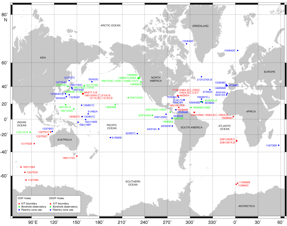
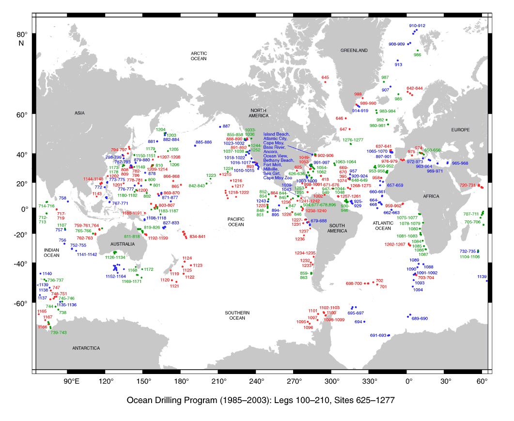
ODP Legs 100–210, Sites 625–1277 (final)
Labeled sites:

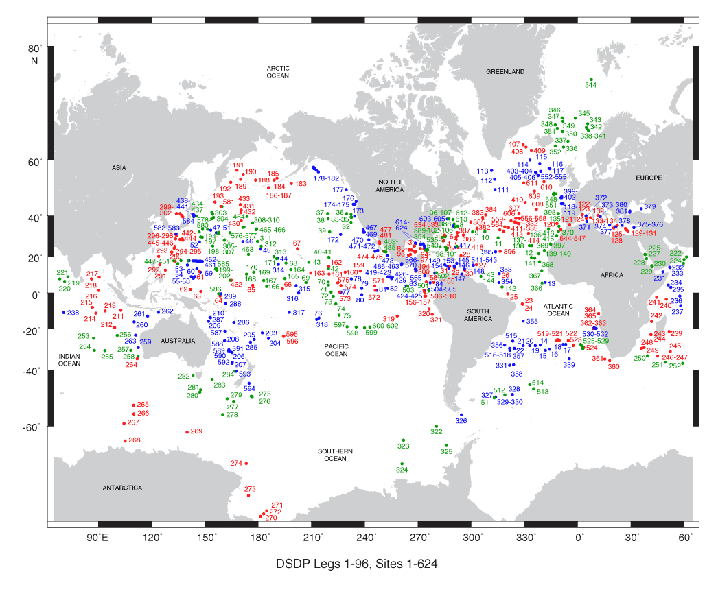
DSDP Legs 1–96, Sites 1–624 (final)